

Features GIS Survey Mobile
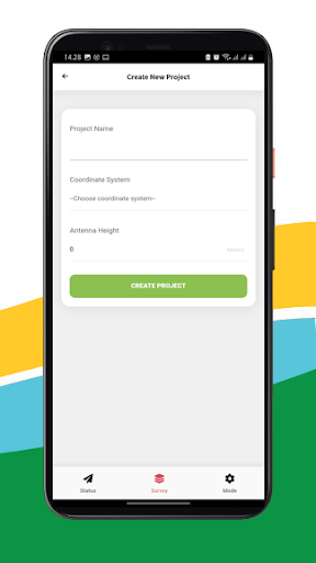
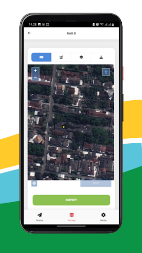
GIS Survey Mobile is an application designed to make it easier for surveyors to perform more efficient topography measurements.GIS Survey Mobile is intended for retrieving Geodetic GNSS Coordinate data from the Equator GNSS Product (recommendation), but if you dont have an Equator GNSS Unit, you can also use it from the Smartphone Internal GPS integration, but the accuracy is not as good as using the Equator Geodetic GNSS.With GIS Survey Mobile, surveyors can determine project activities through simpler command features such as those used for Static measurements, RTK Radio, NTRIP, PPK Mode, and from GIS Survey Mobile later output data in the form of points, lines and areas.Exporting results from data retrieval using GIS Survey Mobile is easier and more convenient, with the stored data having a choice of the required data formats such as .TXT .CSV .GEOJSON.
Apart from that, it is also supported by importing Geojson data which can be used for reference points or work areas that have been planned.Simple application usageFree download from Google Play Store.compatible with android devices.Support all survey modes, including Static, PPK, RTK and NTRIP.Support to serve various survey tasks.
such as Surface Stake, Mapping Survey and etc.Access to real-time open street maps.Support Geojson import and directly use for stake out operations.
Gaming Features
Enjoy immersive gaming experience with various game modes.
Fitness Tracking
Track your workouts and monitor your health metrics.
Productivity Tools
Boost your productivity with powerful tools and features.
See the GIS Survey Mobile in Action
Get the App Today
Available for Android 8.0 and above